 vesseltracker.com
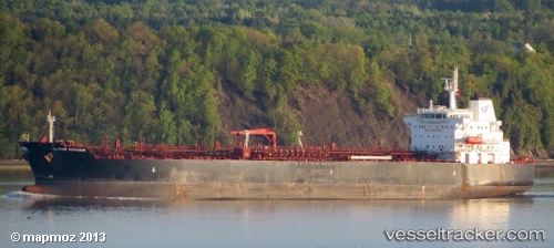
 SWIFT OMAHA
Current Status
Where is the vessel?
SWIFT OMAHA is currently in 74 nm W of Sanyang, based on AIS data received about 14h ago.
Latest AIS update:
Current position: 13.52544° N, 17.98119° W (74 nm W of Sanyang)
Average speed (last 7 days): Loading…
Average speed (last 30 days): Loading…
Vessel profile: SWIFT OMAHA is a Chemical/Oil Products Tanker with dimensions 32m x 183m.
This page combines live AIS, route history, probable destination signals, nearby traffic, and port activity for practical vessel monitoring.
The current position of vessel SWIFT OMAHA is 13.52544 lat / -17.98119 lng. Updated: 2026-05-17 22:21:33 UTCNearest reference points:
- Near Dakar
- Near Rufisque
- 48 nm W of Cap Skiring
Currently sailing under the flag of Marshall Islands ![]()
SWIFT OMAHA built in 2010 year
Deadweight:
46087 tDetails:
Live Vessel SWIFT OMAHA Analytics (details, animations, etc.)
Recent AIS points (UTC):
2026-05-17 19:40:22 UTC · 14.02185, -17.72983 · SOG 12.3 kn · COG 204°2026-05-17 19:48:42 UTC · 13.99623, -17.74284 · SOG 12.3 kn · COG 204°
2026-05-17 22:02:49 UTC · 13.58320, -17.95105 · SOG 12.4 kn · COG 209°
2026-05-17 22:21:33 UTC · 13.52544, -17.98119 · SOG 12.3 kn · COG 208°