 STINNES MISTRAL
Current Status
Where is the vessel?
STINNES MISTRAL is currently in Near Wangerooge, based on AIS data received about 14h ago.
Latest AIS update:
Current position: 53.91713° N, 7.80805° E (Near Wangerooge)
Average speed (last 7 days): Loading…
Average speed (last 30 days): Loading…
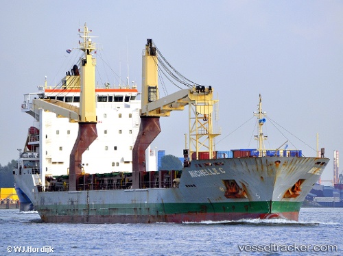
Vessel profile: STINNES MISTRAL is a General Cargo Ship with dimensions 21m x 138m.
This page combines live AIS, route history, probable destination signals, nearby traffic, and port activity for practical vessel monitoring.
The current position of vessel STINNES MISTRAL is 53.91713 lat / 7.80805 lng. Updated: 2026-05-20 04:08:01 UTCNearest reference points:
- Near Wangerooge
- Near Helgoland
- Near Horumersiel
Currently sailing under the flag of Antigua and Barbuda ![]()
STINNES MISTRAL built in 2010 year
Deadweight:
12946 tDetails:
Live Vessel STINNES MISTRAL Analytics (details, animations, etc.)
Recent AIS points (UTC):
2026-05-19 23:59:01 UTC · 53.91710, 7.81187 · SOG 0 kn · COG 215°2026-05-20 01:05:02 UTC · 53.91763, 7.81059 · SOG 0 kn · COG 196°
2026-05-20 02:05:00 UTC · 53.91763, 7.80977 · SOG 0 kn · COG 175°
2026-05-20 04:08:01 UTC · 53.91713, 7.80805 · SOG 0 kn · COG 138°