 vesseltracker.com
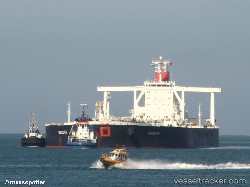
 Mesdar
Current Status
Where is the vessel?
Mesdar is currently in 82 nm NE of Munshiganj, based on AIS data received about 14h ago.
Latest AIS update:
Current position: 24.37667° N, 89.33833° W (82 nm NE of Munshiganj)
Average speed (last 7 days): Loading…
Average speed (last 30 days): Loading…
Vessel profile: Mesdar is a Crude Oil Tanker with dimensions 333m x 333m.
This page combines live AIS, route history, probable destination signals, nearby traffic, and port activity for practical vessel monitoring.
The current position of vessel Mesdar is 24.37667 lat / -89.33833 lng. Updated: 2026-05-18 01:19:05 UTCNearest reference points:
- 94 nm S of Gulfmex Lightering Area
Currently sailing under the flag of Liberia ![]()
Mesdar built in 2007 year
Deadweight:
315802 tDetails:
Live Vessel Mesdar Analytics (details, animations, etc.)
Recent AIS points (UTC):
2026-05-17 22:10:05 UTC · 24.67667, -89.98500 · SOG 12 kn · COG -1°2026-05-17 22:22:07 UTC · 24.65833, -89.94167 · SOG 12 kn · COG -1°
2026-05-17 23:28:08 UTC · 24.55667, -89.71333 · SOG 12 kn · COG -1°
2026-05-18 01:19:05 UTC · 24.37667, -89.33833 · SOG 12 kn · COG -1°