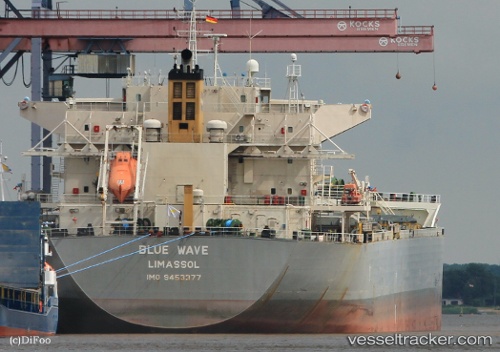
Blue Wave
Current StatusWhere is the vessel?
Blue Wave is currently in Near Narvik, based on AIS data received about 14h ago.
Latest AIS update:
Current position: 68.44282° N, 17.36672° E (Near Narvik)
Average speed (last 7 days): Loading…
Average speed (last 30 days): Loading…
Vessel profile: Blue Wave is a Bulk Carrier with dimensions 37m x 229m.
This page combines live AIS, route history, probable destination signals, nearby traffic, and port activity for practical vessel monitoring.
The current position of vessel Blue Wave is 68.44282 lat / 17.36672 lng. Updated: 2026-07-31 22:59:55 UTCNearest reference points:
- Near Harstad
- Near Skrolsvik
- Near SOMMAROY
Details:
Live Vessel Blue Wave Analytics (details, animations, etc.)
Recent AIS points (UTC):
2026-07-31 19:50:52 UTC · 68.44177, 17.36800 · SOG 0 kn · COG 269°2026-07-31 19:50:54 UTC · 68.44176, 17.36800 · SOG 0 kn · COG 269°
2026-07-31 21:29:55 UTC · 68.44172, 17.36737 · SOG 0 kn · COG 268°
2026-07-31 22:59:55 UTC · 68.44282, 17.36672 · SOG 0.1 kn · COG 239°