 JENGGALA 21
Current Status
Where is the vessel?
JENGGALA 21 is currently in Near Yanbu Industrial City, based on AIS data received about 14h ago.
Latest AIS update:
Current position: 23.92974° N, 38.25428° E (Near Yanbu Industrial City)
Average speed (last 7 days): Loading…
Average speed (last 30 days): Loading…
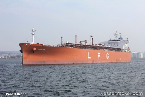
Vessel profile: JENGGALA 21 is a Lpg Tanker with dimensions m x m.
This page combines live AIS, route history, probable destination signals, nearby traffic, and port activity for practical vessel monitoring.
The current position of vessel JENGGALA 21 is 23.92974 lat / 38.25428 lng. Updated: 2026-05-21 08:12:48 UTCNearest reference points:
- 30 nm SW of Yanbu
- 42 nm NW of Fiji
- 35 nm S of Umm Lajj
Currently sailing under the flag of Indonesia ![]()
Details:
Live Vessel JENGGALA 21 Analytics (details, animations, etc.)
Recent AIS points (UTC):
2026-05-21 04:30:50 UTC · 23.92974, 38.25428 · SOG 0 kn · COG 289°2026-05-21 05:21:48 UTC · 23.92976, 38.25429 · SOG 0 kn · COG 289°
2026-05-21 07:15:48 UTC · 23.92972, 38.25426 · SOG 0 kn · COG 289°
2026-05-21 08:12:48 UTC · 23.92974, 38.25428 · SOG 0 kn · COG 289°