 Tango
Tango
Current Status
Where is the vessel?
Tango is currently in Near TANAH MERAH, based on AIS data received about 15h ago.
Latest AIS update:
Current position: 1.29310° N, 104.06473° E (Near TANAH MERAH)
Average speed (last 7 days): Loading…
Average speed (last 30 days): Loading…
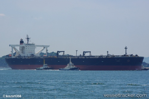
Vessel profile: Tango is a Crude Oil Tanker with dimensions 333m x 60m.
This page combines live AIS, route history, probable destination signals, nearby traffic, and port activity for practical vessel monitoring.
The current position of vessel Tango is 1.29310 lat / 104.06473 lng. Updated: 2026-05-19 16:53:25 UTCNearest reference points:
- Near TANAH MERAH
- Near Changi
- Near Tanjung Setapa
Currently sailing under the flag of Japan ![]()
Tango built in 2009 year
Deadweight:
301662 tDetails:
Live Vessel Tango Analytics (details, animations, etc.)
Recent AIS points (UTC):
2026-05-19 13:11:26 UTC · 1.29017, 104.06176 · SOG 0 kn · COG 89°2026-05-19 14:00:23 UTC · 1.29020, 104.06179 · SOG 0 kn · COG -1°
2026-05-19 15:29:26 UTC · 1.29088, 104.06195 · SOG 0 kn · COG 101°
2026-05-19 16:53:25 UTC · 1.29310, 104.06473 · SOG 0.3 kn · COG 184°