 Monemvasia
Current Status
Where is the vessel?
Monemvasia is currently in 176 nm E of Vinh Cam Ranh, based on AIS data received about 14h ago.
Latest AIS update:
Current position: 11.20833° N, 112.06333° E (176 nm E of Vinh Cam Ranh)
Average speed (last 7 days): Loading…
Average speed (last 30 days): Loading…
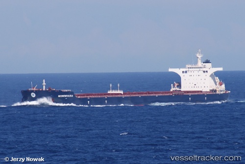
Vessel profile: Monemvasia is a Bulk Carrier with dimensions 292m x 292m.
This page combines live AIS, route history, probable destination signals, nearby traffic, and port activity for practical vessel monitoring.
The current position of vessel Monemvasia is 11.20833 lat / 112.06333 lng. Updated: 2026-06-12 09:18:49 UTCNearest reference points:
- 163 nm E of Vinh Cam Ranh
- 211 nm N of Pulau Lang Lang
- 226 nm SE of Tan Cang Qui Nhon
Currently sailing under the flag of Malta ![]()
Details:
Live Vessel Monemvasia Analytics (details, animations, etc.)
Recent AIS points (UTC):
2026-06-12 05:31:30 UTC · 11.81661, 112.56149 · SOG 11.8 kn · COG -1°2026-06-12 07:27:48 UTC · 11.50667, 112.30667 · SOG 12 kn · COG -1°
2026-06-12 07:27:48 UTC · 11.50667, 112.30667 · SOG 12 kn · COG -1°
2026-06-12 09:18:49 UTC · 11.20833, 112.06333 · SOG 12 kn · COG -1°