 PINGHE
Current Status
Where is the vessel?
PINGHE is currently in 84 nm NE of Ryuo, based on AIS data received about 14h ago.
Latest AIS update:
Current position: 36.26948° N, 18.17070° E (84 nm NE of Ryuo)
Average speed (last 7 days): Loading…
Average speed (last 30 days): Loading…
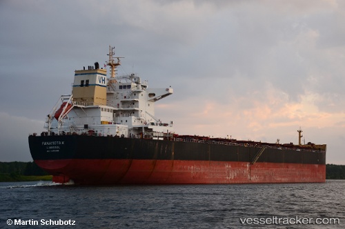
Vessel profile: PINGHE is a Bulk Carrier with dimensions m x m.
This page combines live AIS, route history, probable destination signals, nearby traffic, and port activity for practical vessel monitoring.
The current position of vessel PINGHE is 36.26948 lat / 18.17070 lng. Updated: 2026-06-26 00:22:02 UTCNearest reference points:
- 103 nm NE of Ryuo
- 64 nm NE of Ryuo
- 53 nm NE of Ryuo
Currently sailing under the flag of Panama ![]()
Details:
Live Vessel PINGHE Analytics (details, animations, etc.)
Recent AIS points (UTC):
2026-06-25 20:08:39 UTC · 36.30385, 17.27233 · SOG 10 kn · COG 93°2026-06-25 22:09:00 UTC · 36.28298, 17.69542 · SOG 10.3 kn · COG 92°
2026-06-25 22:19:30 UTC · 36.28153, 17.73278 · SOG 10.3 kn · COG 92°
2026-06-26 00:22:02 UTC · 36.26948, 18.17070 · SOG 10.3 kn · COG 92°