 vesseltracker.com
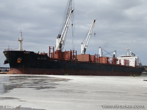
 CLIPPER CLYDE
Current Status
Where is the vessel?
CLIPPER CLYDE is currently in Near Vitoria, based on AIS data received about 1h ago.
Latest AIS update:
Current position: 20.32497° S, 40.34113° W (Near Vitoria)
Average speed (last 7 days): Loading…
Average speed (last 30 days): Loading…
Vessel profile: CLIPPER CLYDE is a Bulk Carrier with dimensions 177m x 27m.
This page combines live AIS, route history, probable destination signals, nearby traffic, and port activity for practical vessel monitoring.
The current position of vessel CLIPPER CLYDE is -20.32497 lat / -40.34113 lng. Updated: 2026-05-14 16:30:07 UTCNearest reference points:
- Near Vitoria
- Near BAIA DE VITORIA
- Near JARDIM CAMBURI
Currently sailing under the flag of Marshall Islands ![]()
CLIPPER CLYDE built in 2012 year
Deadweight:
31639 tDetails:
Live Vessel CLIPPER CLYDE Analytics (details, animations, etc.)
Recent AIS points (UTC):
2026-05-14 13:56:43 UTC · -20.32476, -40.34108 · SOG 0.8 kn · COG 88°2026-05-14 13:58:54 UTC · -20.32497, -40.34123 · SOG 0.1 kn · COG 87°
2026-05-14 16:27:05 UTC · -20.32498, -40.34110 · SOG 0 kn · COG 88°
2026-05-14 16:30:07 UTC · -20.32497, -40.34113 · SOG 0 kn · COG 89°