 Seafrontier
Current Status
Where is the vessel?
Seafrontier is currently in Near Rosarito Terminal, based on AIS data received about 14h ago.
Latest AIS update:
Current position: 32.32696° N, 117.11253° W (Near Rosarito Terminal)
Average speed (last 7 days): Loading…
Average speed (last 30 days): Loading…
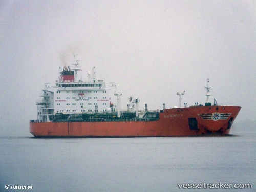
Vessel profile: Seafrontier is a Oil Products Tanker with dimensions 183m x 183m.
This page combines live AIS, route history, probable destination signals, nearby traffic, and port activity for practical vessel monitoring.
The current position of vessel Seafrontier is 32.32696 lat / -117.11253 lng. Updated: 2026-06-22 13:17:44 UTCNearest reference points:
- Near San Diego
- Near Coronado
- Near Ocean Beach
Currently sailing under the flag of Hong Kong ![]()
Seafrontier built in 2011 year
Deadweight:
50500 tDetails:
Live Vessel Seafrontier Analytics (details, animations, etc.)
Recent AIS points (UTC):
2026-06-22 09:59:43 UTC · 32.32670, -117.11323 · SOG 0 kn · COG 343°2026-06-22 10:02:43 UTC · 32.32667, -117.11328 · SOG 0 kn · COG 344°
2026-06-22 11:50:45 UTC · 32.32686, -117.11284 · SOG 0 kn · COG 334°
2026-06-22 13:17:44 UTC · 32.32696, -117.11253 · SOG 0 kn · COG 325°