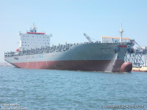
 Wan Hai 517
Current Status
Where is the vessel?
Wan Hai 517 is currently in Near WAILINGDING ISLAND, based on AIS data received about 15h ago.
Latest AIS update:
Current position: 22.01542° N, 114.10763° E (Near WAILINGDING ISLAND)
Average speed (last 7 days): Loading…
Average speed (last 30 days): Loading…
Vessel profile: Wan Hai 517 is a Container Ship with dimensions 259m x 37m.
This page combines live AIS, route history, probable destination signals, nearby traffic, and port activity for practical vessel monitoring.
The current position of vessel Wan Hai 517 is 22.01542 lat / 114.10763 lng. Updated: 2026-06-17 18:16:46 UTCNearest reference points:
- Near WAILINGDING ISLAND
- Near Pok Fu Lam
- Near Cheung Sha Wan
Currently sailing under the flag of Singapore ![]()
Details:
Live Vessel Wan Hai 517 Analytics (details, animations, etc.)
Recent AIS points (UTC):
2026-06-17 13:49:50 UTC · 22.27174, 113.80736 · SOG 14.9 kn · COG 168°2026-06-17 16:01:35 UTC · 21.99888, 113.97034 · SOG 11.8 kn · COG 73°
2026-06-17 17:04:46 UTC · 22.01471, 114.10760 · SOG 0.1 kn · COG 87°
2026-06-17 18:16:46 UTC · 22.01542, 114.10763 · SOG 0.1 kn · COG 103°