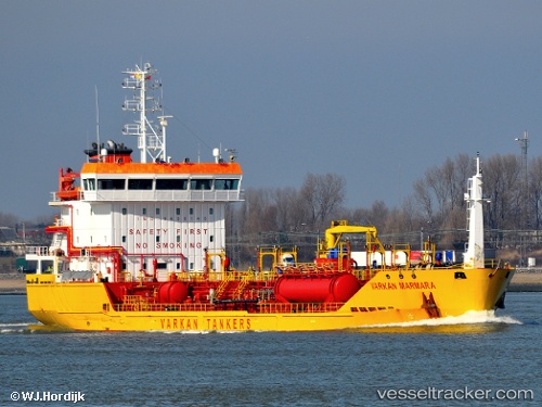
 Varkan Marmara
Current Status
Where is the vessel?
Varkan Marmara is currently in Near Sestao/Bilbao, based on AIS data received about 17h ago.
Latest AIS update:
Current position: 43.29033° N, 2.97217° W (Near Sestao/Bilbao)
Average speed (last 7 days): Loading…
Average speed (last 30 days): Loading…
Vessel profile: Varkan Marmara is a Chemical Tanker with dimensions 100m x 16m.
This page combines live AIS, route history, probable destination signals, nearby traffic, and port activity for practical vessel monitoring.
The current position of vessel Varkan Marmara is 43.29033 lat / -2.97217 lng. Updated: 2026-07-14 23:27:49 UTCNearest reference points:
- Near Santurtz
- Near Zierbena
- Near Mundaka
Currently sailing under the flag of Turkey ![]()
Varkan Marmara built in 2009 year
Deadweight:
4865 tDetails:
Live Vessel Varkan Marmara Analytics (details, animations, etc.)
Recent AIS points (UTC):
2026-07-14 23:27:49 UTC · 43.29033, -2.97217 · SOG 0 kn · COG 163°2026-07-14 23:27:49 UTC · 43.29033, -2.97217 · SOG 0 kn · COG 163°
2026-07-14 23:27:49 UTC · 43.29033, -2.97217 · SOG 0 kn · COG 163°
2026-07-14 23:27:49 UTC · 43.29033, -2.97217 · SOG 0 kn · COG 163°