 SKALAR
Current Status
Where is the vessel?
SKALAR is currently in Near Haarlemmermeer, based on AIS data received about 15h ago.
Latest AIS update:
Current position: 51.95789° N, 3.99597° E (Near Haarlemmermeer)
Average speed (last 7 days): Loading…
Average speed (last 30 days): Loading…
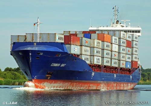
Vessel profile: SKALAR is a Container Ship with dimensions 151m x 24m.
This page combines live AIS, route history, probable destination signals, nearby traffic, and port activity for practical vessel monitoring.
The current position of vessel SKALAR is 51.95789 lat / 3.99597 lng. Updated: 2026-05-20 10:25:54 UTCNearest reference points:
- Near MAASVLAKTE - ROTTERDAM
- Near Haarlemmermeer
- Near HOEK VAN HOLLAND
Currently sailing under the flag of Portugal ![]()
SKALAR built in 2012 year
Deadweight:
13000 tDetails:
Live Vessel SKALAR Analytics (details, animations, etc.)
Recent AIS points (UTC):
2026-05-20 07:44:18 UTC · 51.96005, 3.99799 · SOG 2.5 kn · COG 83°2026-05-20 08:06:24 UTC · 51.95791, 3.99591 · SOG 0.2 kn · COG 354°
2026-05-20 09:41:27 UTC · 51.95790, 3.99592 · SOG 0 kn · COG 355°
2026-05-20 10:25:54 UTC · 51.95789, 3.99597 · SOG 0 kn · COG 356°