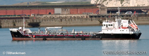
Bintang Timur
Current StatusWhere is the vessel?
Bintang Timur is currently in Near PASIR PANJANG Terminal, based on AIS data received about 14h ago.
Latest AIS update:
Current position: 1.30319° N, 103.75469° E (Near PASIR PANJANG Terminal)
Average speed (last 7 days): Loading…
Average speed (last 30 days): Loading…
Vessel profile: Bintang Timur is a Offshore Tug Supply Ship with dimensions 11m x 57m.
This page combines live AIS, route history, probable destination signals, nearby traffic, and port activity for practical vessel monitoring.
The current position of vessel Bintang Timur is 1.30319 lat / 103.75469 lng. Updated: 2026-05-19 04:06:18 UTCNearest reference points:
- Near PASIR PANJANG Terminal
- Near Jurong/Singapore
- Near Pulau Ayer Chawan
Details:
Live Vessel Bintang Timur Analytics (details, animations, etc.)
Recent AIS points (UTC):
2026-05-19 02:06:20 UTC · 1.30310, 103.75469 · SOG 0 kn · COG 51°2026-05-19 02:12:17 UTC · 1.30308, 103.75465 · SOG 0 kn · COG 52°
2026-05-19 03:36:17 UTC · 1.30318, 103.75471 · SOG 0 kn · COG 46°
2026-05-19 04:06:18 UTC · 1.30319, 103.75469 · SOG 0 kn · COG 45°