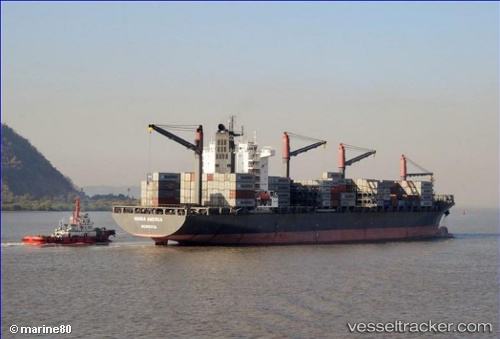
 MAERSK NACALA
Current Status
Where is the vessel?
MAERSK NACALA is currently in Near Hillsboro Beach, based on AIS data received about 14h ago.
Latest AIS update:
Current position: 26.33712° N, 79.94527° W (Near Hillsboro Beach)
Average speed (last 7 days): Loading…
Average speed (last 30 days): Loading…
Vessel profile: MAERSK NACALA is a Container Ship with dimensions 32m x 240m.
This page combines live AIS, route history, probable destination signals, nearby traffic, and port activity for practical vessel monitoring.
The current position of vessel MAERSK NACALA is 26.33712 lat / -79.94527 lng. Updated: 2026-05-20 07:30:36 UTCNearest reference points:
- Near Hillsboro Beach
- Near Lighthouse Point
- Near Pompano Beach
Currently sailing under the flag of Singapore ![]()
MAERSK NACALA built in 2014 year
Deadweight:
47068 tDetails:
Live Vessel MAERSK NACALA Analytics (details, animations, etc.)
Recent AIS points (UTC):
2026-05-20 04:40:03 UTC · 26.97201, -79.79524 · SOG 14 kn · COG 189°2026-05-20 05:56:04 UTC · 26.68975, -79.86580 · SOG 13.8 kn · COG 187°
2026-05-20 07:19:47 UTC · 26.37729, -79.93791 · SOG 13.5 kn · COG 189°
2026-05-20 07:30:36 UTC · 26.33712, -79.94527 · SOG 13.4 kn · COG 189°