 BALU 6
Current Status
Where is the vessel?
BALU 6 is currently in Near VISTINO, based on AIS data received about 15h ago.
Latest AIS update:
Current position: 59.82881° N, 28.41547° E (Near VISTINO)
Average speed (last 7 days): Loading…
Average speed (last 30 days): Loading…
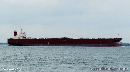
Vessel profile: BALU 6 is a Crude Oil Tanker with dimensions m x m.
This page combines live AIS, route history, probable destination signals, nearby traffic, and port activity for practical vessel monitoring.
The current position of vessel BALU 6 is 59.82881 lat / 28.41547 lng. Updated: 2026-05-20 13:49:51 UTCNearest reference points:
- Near VISTINO
- Near Ruch’I
- Near Ust-Luga
Currently sailing under the flag of Panama ![]()
Details:
Live Vessel BALU 6 Analytics (details, animations, etc.)
Recent AIS points (UTC):
2026-05-20 09:05:13 UTC · 59.82872, 28.41518 · SOG 0 kn · COG 307°2026-05-20 09:05:13 UTC · 59.82872, 28.41518 · SOG 0 kn · COG 307°
2026-05-20 13:02:16 UTC · 59.82908, 28.41539 · SOG 0 kn · COG 296°
2026-05-20 13:49:51 UTC · 59.82881, 28.41547 · SOG 0 kn · COG 296°