 MINERVA PROVIDENCE
Current Status
Where is the vessel?
MINERVA PROVIDENCE is currently in 117 nm NE of Jingjiang, based on AIS data received about 14h ago.
Latest AIS update:
Current position: 32.22027° N, 124.26194° E (117 nm NE of Jingjiang)
Average speed (last 7 days): Loading…
Average speed (last 30 days): Loading…
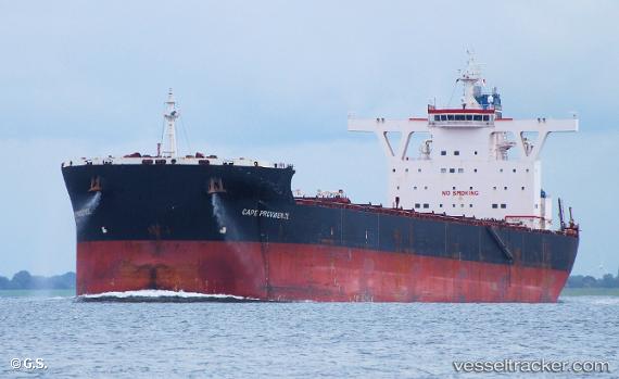
Vessel profile: MINERVA PROVIDENCE is a Bulk Carrier with dimensions 290m x 45m.
This page combines live AIS, route history, probable destination signals, nearby traffic, and port activity for practical vessel monitoring.
The current position of vessel MINERVA PROVIDENCE is 32.22027 lat / 124.26194 lng. Updated: 2026-05-26 00:01:38 UTCNearest reference points:
- 117 nm NE of Jingjiang
- 96 nm SW of Hwasun
- 70 nm NE of Jingjiang
Currently sailing under the flag of Malta ![]()
MINERVA PROVIDENCE built in 2010 year
Deadweight:
169234 tDetails:
Live Vessel MINERVA PROVIDENCE Analytics (details, animations, etc.)
Recent AIS points (UTC):
2026-05-25 19:38:56 UTC · 31.36337, 124.58846 · SOG 11.6 kn · COG -1°2026-05-25 21:59:10 UTC · 31.80731, 124.40340 · SOG 12.6 kn · COG -1°
2026-05-25 22:05:58 UTC · 31.83220, 124.39339 · SOG 12.6 kn · COG 341°
2026-05-26 00:01:38 UTC · 32.22027, 124.26194 · SOG 12.3 kn · COG -1°