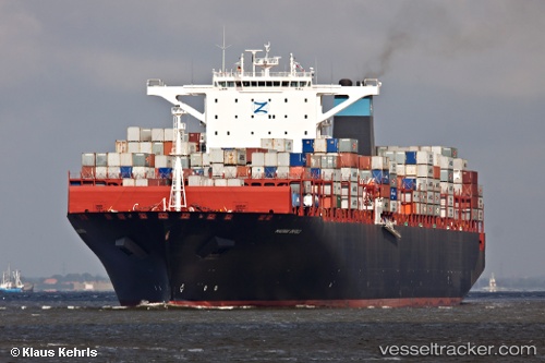
Msc Emma
Current StatusWhere is the vessel?
Msc Emma is currently in Near JURONG ISLAND, based on AIS data received about 14h ago.
Latest AIS update:
Current position: 1.25414° N, 103.62714° E (Near JURONG ISLAND)
Average speed (last 7 days): Loading…
Average speed (last 30 days): Loading…
Vessel profile: Msc Emma is a Container Ship with dimensions 48m x 366m.
This page combines live AIS, route history, probable destination signals, nearby traffic, and port activity for practical vessel monitoring.
The current position of vessel Msc Emma is 1.25414 lat / 103.62714 lng. Updated: 2026-05-22 07:40:07 UTCNearest reference points:
- Near JURONG ISLAND
- Near Tuas
- Near Pulau Ayer Chawan
Details:
Live Vessel Msc Emma Analytics (details, animations, etc.)
Recent AIS points (UTC):
2026-05-22 04:17:49 UTC · 1.20446, 103.67357 · SOG 0 kn · COG 237°2026-05-22 04:20:23 UTC · 1.20449, 103.67356 · SOG 0 kn · COG 238°
2026-05-22 05:26:30 UTC · 1.20348, 103.67265 · SOG 0.1 kn · COG 235°
2026-05-22 07:40:07 UTC · 1.25414, 103.62714 · SOG 0 kn · COG 269°