 vesseltracker.com
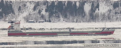
 Edenborg
Current Status
Where is the vessel?
Edenborg is currently in Near Melvindale, based on AIS data received less than 1h ago.
Latest AIS update:
Current position: 42.25994° N, 83.10849° W (Near Melvindale)
Average speed (last 7 days): Loading…
Average speed (last 30 days): Loading…
Vessel profile: Edenborg is a General Cargo Ship with dimensions 138m x 16m.
This page combines live AIS, route history, probable destination signals, nearby traffic, and port activity for practical vessel monitoring.
The current position of vessel Edenborg is 42.25994 lat / -83.10849 lng. Updated: 2026-05-15 17:55:06 UTCNearest reference points:
- Near Walkerville
- Near Saint Clair Shores
- Near Put-In-Bay
Currently sailing under the flag of Netherlands ![]()
Edenborg built in 2010 year
Deadweight:
10750 tDetails:
Live Vessel Edenborg Analytics (details, animations, etc.)
Recent AIS points (UTC):
2026-05-15 13:46:26 UTC · 42.25992, -83.10860 · SOG 0 kn · COG 39°2026-05-15 16:07:08 UTC · 42.25992, -83.10855 · SOG 0 kn · COG 40°
2026-05-15 16:16:07 UTC · 42.25991, -83.10849 · SOG 0 kn · COG 38°
2026-05-15 17:55:06 UTC · 42.25994, -83.10849 · SOG 0 kn · COG 40°