 Robert Oldendorff
Current Status
Where is the vessel?
Robert Oldendorff is currently in 10 nm NE of DHAMRA, based on AIS data received about 14h ago.
Latest AIS update:
Current position: 20.92260° N, 87.11512° E (10 nm NE of DHAMRA)
Average speed (last 7 days): Loading…
Average speed (last 30 days): Loading…
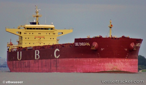
Vessel profile: Robert Oldendorff is a Bulk Carrier with dimensions 260m x 260m.
This page combines live AIS, route history, probable destination signals, nearby traffic, and port activity for practical vessel monitoring.
The current position of vessel Robert Oldendorff is 20.92260 lat / 87.11512 lng. Updated: 2026-05-21 06:22:15 UTCNearest reference points:
- 45 nm S of Contai
- Near Paradip
- Near Paradip Garh
Currently sailing under the flag of Liberia ![]()
Robert Oldendorff built in 2011 year
Deadweight:
118590 tDetails:
Live Vessel Robert Oldendorff Analytics (details, animations, etc.)
Recent AIS points (UTC):
2026-05-21 04:26:56 UTC · 20.93963, 87.13841 · SOG 0 kn · COG 148°2026-05-21 05:41:55 UTC · 20.93896, 87.13492 · SOG 0.4 kn · COG 129°
2026-05-21 06:22:15 UTC · 20.92260, 87.11512 · SOG 5.9 kn · COG 222°
2026-05-21 06:22:15 UTC · 20.92260, 87.11512 · SOG 5.9 kn · COG 222°