 Amarula Sun
Current Status
Where is the vessel?
Amarula Sun is currently in Near Lyford Cay, based on AIS data received about 14h ago.
Latest AIS update:
Current position: 25.00352° N, 77.50829° W (Near Lyford Cay)
Average speed (last 7 days): Loading…
Average speed (last 30 days): Loading…
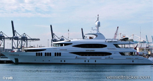
Vessel profile: Amarula Sun is a Service Ship with dimensions 50m x 10m.
This page combines live AIS, route history, probable destination signals, nearby traffic, and port activity for practical vessel monitoring.
The current position of vessel Amarula Sun is 25.00352 lat / -77.50829 lng. Updated: 2026-05-20 23:09:41 UTCNearest reference points:
- Near Lyford Cay
- Near Nassau
- 11 nm S of Lyford Cay
Currently sailing under the flag of Jamaica ![]()
Details:
Live Vessel Amarula Sun Analytics (details, animations, etc.)
Recent AIS points (UTC):
2026-05-20 17:51:41 UTC · 25.00352, -77.50824 · SOG 0 kn · COG 274°2026-05-20 19:09:41 UTC · 25.00351, -77.50823 · SOG 0 kn · COG 274°
2026-05-20 21:57:29 UTC · 25.00348, -77.50825 · SOG 0 kn · COG 274°
2026-05-20 23:09:41 UTC · 25.00352, -77.50829 · SOG 0 kn · COG 274°