 YALOUSSA
Current Status
Where is the vessel?
YALOUSSA is currently in 39 nm S of Cabuya Cobano, based on AIS data received about 14h ago.
Latest AIS update:
Current position: 8.95334° N, 85.00642° W (39 nm S of Cabuya Cobano)
Average speed (last 7 days): Loading…
Average speed (last 30 days): Loading…
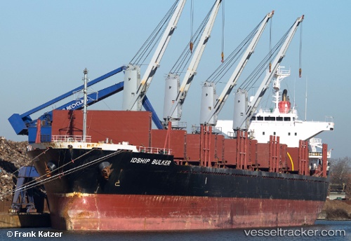
Vessel profile: YALOUSSA is a Bulk Carrier with dimensions 28m x 169m.
This page combines live AIS, route history, probable destination signals, nearby traffic, and port activity for practical vessel monitoring.
The current position of vessel YALOUSSA is 8.95334 lat / -85.00642 lng. Updated: 2026-05-20 16:19:07 UTCNearest reference points:
- 67 nm SW of Sámara
- Near Golfo de Papagayo
- 27 nm W of Playa Conchal
Currently sailing under the flag of Marshall Islands ![]()
YALOUSSA built in 2008 year
Deadweight:
28361 tDetails:
Live Vessel YALOUSSA Analytics (details, animations, etc.)
Recent AIS points (UTC):
2026-05-20 13:53:03 UTC · 9.22138, -85.32201 · SOG 9.9 kn · COG 132°2026-05-20 13:53:03 UTC · 9.22138, -85.32201 · SOG 9.9 kn · COG 132°
2026-05-20 16:19:07 UTC · 8.95334, -85.00642 · SOG 10 kn · COG 130°
2026-05-20 16:19:07 UTC · 8.95334, -85.00642 · SOG 10 kn · COG 130°