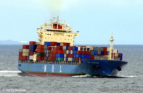
 SM TIANJIN
Current Status
Where is the vessel?
SM TIANJIN is currently in 72 nm NW of Oga, based on AIS data received about 15h ago.
Latest AIS update:
Current position: 40.33835° N, 138.37372° E (72 nm NW of Oga)
Average speed (last 7 days): Loading…
Average speed (last 30 days): Loading…
Vessel profile: SM TIANJIN is a Container Ship with dimensions 32m x 259m.
This page combines live AIS, route history, probable destination signals, nearby traffic, and port activity for practical vessel monitoring.
The current position of vessel SM TIANJIN is 40.33835 lat / 138.37372 lng. Updated: 2026-06-03 10:30:51 UTCNearest reference points:
- 63 nm NW of Sado Shima Apt
- Near Muroran
Currently sailing under the flag of Korea (Republic of) ![]()
SM TIANJIN built in 2010 year
Deadweight:
54344 tDetails:
Live Vessel SM TIANJIN Analytics (details, animations, etc.)
Recent AIS points (UTC):
2026-06-03 08:00:10 UTC · 40.89968, 139.19463 · SOG 19.7 kn · COG -1°2026-06-03 09:05:20 UTC · 40.65658, 138.83148 · SOG 19.5 kn · COG -1°
2026-06-03 09:44:38 UTC · 40.50833, 138.62318 · SOG 19.8 kn · COG 228°
2026-06-03 10:30:51 UTC · 40.33835, 138.37372 · SOG 19.9 kn · COG 230°