 vesseltracker.com
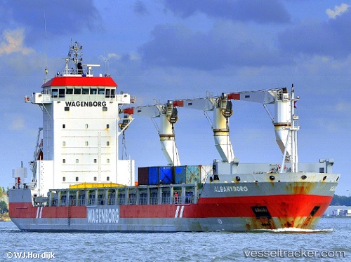
Albanyborg
Current StatusWhere is the vessel?
Albanyborg is currently in 11 nm W of Molengat, based on AIS data received less than 1h ago.
Latest AIS update:
Current position: 53.01352° N, 4.36001° E (11 nm W of Molengat)
Average speed (last 7 days): Loading…
Average speed (last 30 days): Loading…
Vessel profile: Albanyborg is a General Cargo Ship with dimensions 21m x 143m.
This page combines live AIS, route history, probable destination signals, nearby traffic, and port activity for practical vessel monitoring.
The current position of vessel Albanyborg is 53.01352 lat / 4.36001 lng. Updated: 2026-05-16 01:28:04 UTCNearest reference points:
- Near Molengat
- Near Den Helder
- Near Stolpen
Details:
Live Vessel Albanyborg Analytics (details, animations, etc.)
Recent AIS points (UTC):
2026-05-15 21:47:16 UTC · 52.40916, 3.61493 · SOG 11.5 kn · COG 27°2026-05-15 22:11:55 UTC · 52.47543, 3.68393 · SOG 11.8 kn · COG 42°
2026-05-15 23:46:04 UTC · 52.69829, 4.06484 · SOG 12.5 kn · COG 45°
2026-05-16 01:28:04 UTC · 53.01352, 4.36001 · SOG 12.8 kn · COG 14°