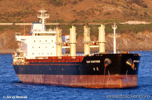
Sam Panther
Current StatusWhere is the vessel?
Sam Panther is currently in Near Bridgetown, based on AIS data received about 15h ago.
Latest AIS update:
Current position: 13.10283° N, 59.62915° W (Near Bridgetown)
Average speed (last 7 days): Loading…
Average speed (last 30 days): Loading…
Vessel profile: Sam Panther is a Bulk Carrier with dimensions 29m x 179m.
This page combines live AIS, route history, probable destination signals, nearby traffic, and port activity for practical vessel monitoring.
The current position of vessel Sam Panther is 13.10283 lat / -59.62915 lng. Updated: 2026-05-19 19:55:43 UTCNearest reference points:
- Near Saint Michael
- Near Kingstown
- Near Gros Islet
Details:
Live Vessel Sam Panther Analytics (details, animations, etc.)
Recent AIS points (UTC):
2026-05-19 17:04:43 UTC · 13.10301, -59.62919 · SOG 0.1 kn · COG 161°2026-05-19 18:22:43 UTC · 13.10298, -59.62921 · SOG 0 kn · COG 161°
2026-05-19 19:10:44 UTC · 13.10303, -59.62918 · SOG 0.1 kn · COG 161°
2026-05-19 19:55:43 UTC · 13.10283, -59.62915 · SOG 0 kn · COG 161°