 vesseltracker.com
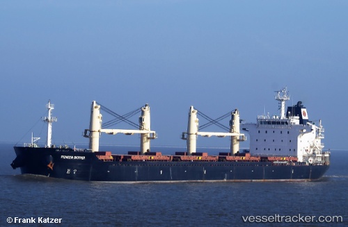
 Agia Doxa
Current Status
Where is the vessel?
Agia Doxa is currently in Near Veracruz, based on AIS data received less than 1h ago.
Latest AIS update:
Current position: 19.25416° N, 96.12259° W (Near Veracruz)
Average speed (last 7 days): Loading…
Average speed (last 30 days): Loading…
Vessel profile: Agia Doxa is a Bulk Carrier with dimensions 179m x 29m.
This page combines live AIS, route history, probable destination signals, nearby traffic, and port activity for practical vessel monitoring.
The current position of vessel Agia Doxa is 19.25416 lat / -96.12259 lng. Updated: 2026-05-13 21:44:15 UTCNearest reference points:
- Near Veracruz
- 25 nm E of Tuxpan
- Near Coatzacoalcos
Currently sailing under the flag of Liberia ![]()
Agia Doxa built in 2010 year
Deadweight:
33261 tDetails:
Live Vessel Agia Doxa Analytics (details, animations, etc.)
Recent AIS points (UTC):
2026-05-13 18:01:13 UTC · 19.22541, -96.16724 · SOG 0 kn · COG 350°2026-05-13 19:28:15 UTC · 19.22544, -96.16722 · SOG 0 kn · COG 350°
2026-05-13 20:25:12 UTC · 19.22551, -96.16725 · SOG 0 kn · COG 350°
2026-05-13 21:44:15 UTC · 19.25416, -96.12259 · SOG 7.8 kn · COG 336°