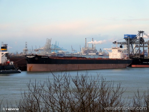
Aquamarine
Current StatusWhere is the vessel?
Aquamarine is currently in 247 nm E of Tarpon Springs, based on AIS data received about 14h ago.
Latest AIS update:
Current position: 29.69043° N, 24.15590° W (247 nm E of Tarpon Springs)
Average speed (last 7 days): Loading…
Average speed (last 30 days): Loading…
Vessel profile: Aquamarine is a Bulk Carrier with dimensions 45m x 292m.
This page combines live AIS, route history, probable destination signals, nearby traffic, and port activity for practical vessel monitoring.
The current position of vessel Aquamarine is 29.69043 lat / -24.15590 lng. Updated: 2026-05-21 13:21:30 UTCDetails:
Live Vessel Aquamarine Analytics (details, animations, etc.)
Recent AIS points (UTC):
2026-05-21 10:21:29 UTC · 30.01012, -23.55108 · SOG 12.5 kn · COG 239°2026-05-21 11:21:58 UTC · 29.90295, -23.75857 · SOG 12.4 kn · COG 239°
2026-05-21 13:21:30 UTC · 29.69043, -24.15590 · SOG 11.9 kn · COG 240°
2026-05-21 13:21:30 UTC · 29.69043, -24.15590 · SOG 11.9 kn · COG 240°