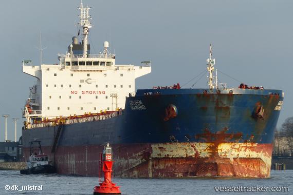
 PACIFIC STAR
Current Status
Where is the vessel?
PACIFIC STAR is currently in Near Taboneo, based on AIS data received about 15h ago.
Latest AIS update:
Current position: 3.73572° S, 114.48662° E (Near Taboneo)
Average speed (last 7 days): Loading…
Average speed (last 30 days): Loading…
Vessel profile: PACIFIC STAR is a Bulk Carrier with dimensions m x m.
This page combines live AIS, route history, probable destination signals, nearby traffic, and port activity for practical vessel monitoring.
The current position of vessel PACIFIC STAR is -3.73572 lat / 114.48662 lng. Updated: 2026-07-02 19:48:11 UTCNearest reference points:
- Near Taboneo
- Near BANJARMASIN
- Near Bunati
Currently sailing under the flag of Liberia ![]()
Details:
Live Vessel PACIFIC STAR Analytics (details, animations, etc.)
Recent AIS points (UTC):
2026-07-02 16:43:51 UTC · -3.73604, 114.48578 · SOG 0 kn · COG 151°2026-07-02 17:25:51 UTC · -3.73589, 114.48598 · SOG 0.1 kn · COG 156°
2026-07-02 19:34:51 UTC · -3.73571, 114.48655 · SOG 0 kn · COG 171°
2026-07-02 19:48:11 UTC · -3.73572, 114.48662 · SOG 0 kn · COG -1°