 TRUE HARMONY
Current Status
Where is the vessel?
TRUE HARMONY is currently in 116 nm E of Alozaina, based on AIS data received about 15h ago.
Latest AIS update:
Current position: 36.55333° N, 12.44167° W (116 nm E of Alozaina)
Average speed (last 7 days): Loading…
Average speed (last 30 days): Loading…
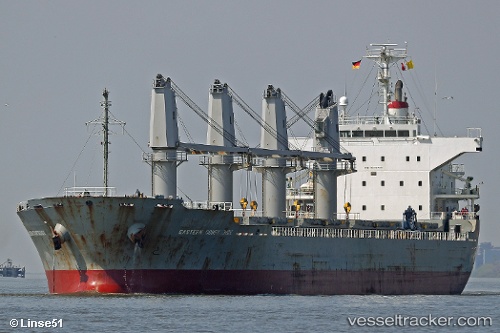
Vessel profile: TRUE HARMONY is a Bulk Carrier with dimensions 28m x 169m.
This page combines live AIS, route history, probable destination signals, nearby traffic, and port activity for practical vessel monitoring.
The current position of vessel TRUE HARMONY is 36.55333 lat / -12.44167 lng. Updated: 2026-06-13 14:00:00 UTCNearest reference points:
- 118 nm NE of Nedroma
- 116 nm NE of Nedroma
- 115 nm E of Nedroma
Currently sailing under the flag of Barbados ![]()
TRUE HARMONY built in 2008 year
Deadweight:
28449 tDetails:
Live Vessel TRUE HARMONY Analytics (details, animations, etc.)
Recent AIS points (UTC):
2026-06-13 09:42:00 UTC · 37.41167, -12.23667 · SOG 12 kn · COG -1°2026-06-13 12:09:00 UTC · 36.91833, -12.35667 · SOG 12 kn · COG -1°
2026-06-13 13:27:01 UTC · 36.66333, -12.41833 · SOG 12 kn · COG -1°
2026-06-13 14:00:00 UTC · 36.55333, -12.44167 · SOG 12 kn · COG -1°