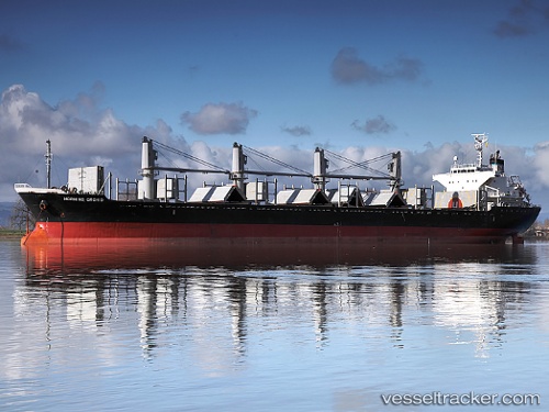
 MP FORTUNE
Current Status
Where is the vessel?
MP FORTUNE is currently in 78 nm SW of Calatagan, based on AIS data received about 14h ago.
Latest AIS update:
Current position: 13.19312° N, 119.46092° E (78 nm SW of Calatagan)
Average speed (last 7 days): Loading…
Average speed (last 30 days): Loading…
Vessel profile: MP FORTUNE is a Bulk Carrier with dimensions m x m.
This page combines live AIS, route history, probable destination signals, nearby traffic, and port activity for practical vessel monitoring.
The current position of vessel MP FORTUNE is 13.19312 lat / 119.46092 lng. Updated: 2026-07-03 17:04:46 UTCNearest reference points:
- 65 nm NW of Malampaya
- 19 nm SW of MARIVELES
- Near Nasugbu, Luzon
Currently sailing under the flag of Panama ![]()
Details:
Live Vessel MP FORTUNE Analytics (details, animations, etc.)
Recent AIS points (UTC):
2026-07-01 13:03:57 UTC · 4.51467, 123.65828 · SOG 11.5 kn · COG -1°2026-07-03 15:39:08 UTC · 13.02630, 119.66760 · SOG 11 kn · COG -1°
2026-07-03 16:24:36 UTC · 13.11815, 119.55447 · SOG 11.4 kn · COG -1°
2026-07-03 17:04:46 UTC · 13.19312, 119.46092 · SOG 11.3 kn · COG -1°