 MARIA MAJESTY
Current Status
Where is the vessel?
MARIA MAJESTY is currently in Near Ardjuna, based on AIS data received about 14h ago.
Latest AIS update:
Current position: 5.88203° S, 105.98599° E (Near Ardjuna)
Average speed (last 7 days): Loading…
Average speed (last 30 days): Loading…
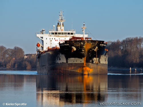
Vessel profile: MARIA MAJESTY is a Chemical/Oil Products Tanker with dimensions 182m x 34m.
This page combines live AIS, route history, probable destination signals, nearby traffic, and port activity for practical vessel monitoring.
The current position of vessel MARIA MAJESTY is -5.88203 lat / 105.98599 lng. Updated: 2026-05-19 13:12:43 UTCNearest reference points:
- Near MERAK
- Near Ardjuna
- Near SURALAYA
Currently sailing under the flag of Marshall Islands ![]()
MARIA MAJESTY built in 2009 year
Deadweight:
47147 tDetails:
Live Vessel MARIA MAJESTY Analytics (details, animations, etc.)
Recent AIS points (UTC):
2026-05-19 10:20:43 UTC · -5.88141, 105.98595 · SOG 0.1 kn · COG 101°2026-05-19 11:12:41 UTC · -5.88124, 105.98591 · SOG 0 kn · COG 101°
2026-05-19 11:38:35 UTC · -5.88173, 105.98585 · SOG 0 kn · COG 85°
2026-05-19 13:12:43 UTC · -5.88203, 105.98599 · SOG 0 kn · COG 74°