 vesseltracker.com
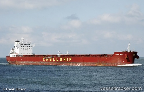
 BLUE SPIRIT
Current Status
Where is the vessel?
BLUE SPIRIT is currently in 27 nm E of DHAMRA, based on AIS data received about 16h ago.
Latest AIS update:
Current position: 20.98022° N, 87.42399° E (27 nm E of DHAMRA)
Average speed (last 7 days): Loading…
Average speed (last 30 days): Loading…
Vessel profile: BLUE SPIRIT is a Bulk Carrier with dimensions m x m.
This page combines live AIS, route history, probable destination signals, nearby traffic, and port activity for practical vessel monitoring.
The current position of vessel BLUE SPIRIT is 20.98022 lat / 87.42399 lng. Updated: 2026-05-18 04:49:01 UTCNearest reference points:
- 45 nm S of Contai
- 61 nm E of DHAMRA
- 16 nm SE of Contai
Currently sailing under the flag of Marshall Islands ![]()
Details:
Live Vessel BLUE SPIRIT Analytics (details, animations, etc.)
Recent AIS points (UTC):
2026-05-18 03:21:58 UTC · 20.91377, 87.11764 · SOG 4.9 kn · COG 81°2026-05-18 04:35:29 UTC · 20.97025, 87.37187 · SOG 13.4 kn · COG 81°
2026-05-18 04:49:01 UTC · 20.98022, 87.42399 · SOG 13.6 kn · COG 81°
2026-05-18 04:49:01 UTC · 20.98022, 87.42399 · SOG 13.6 kn · COG 81°