 Log in Jacaranda
Current Status
Where is the vessel?
Log in Jacaranda is currently in 37 nm NE of Icapuí, based on AIS data received about 15h ago.
Latest AIS update:
Current position: 4.23722° S, 36.93597° W (37 nm NE of Icapuí)
Average speed (last 7 days): Loading…
Average speed (last 30 days): Loading…
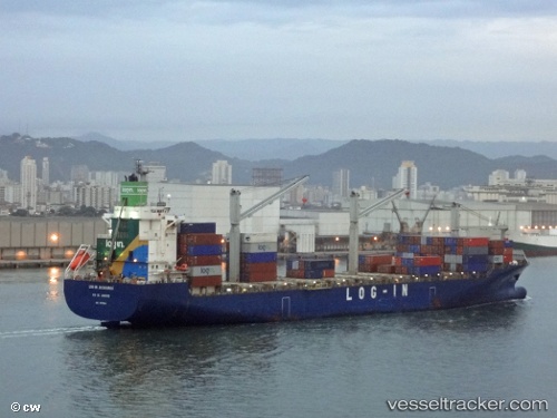
Vessel profile: Log in Jacaranda is a Container Ship with dimensions 217m x 28m.
This page combines live AIS, route history, probable destination signals, nearby traffic, and port activity for practical vessel monitoring.
The current position of vessel Log in Jacaranda is -4.23722 lat / -36.93597 lng. Updated: 2026-05-20 19:18:43 UTCNearest reference points:
- 28 nm N of Pecém Pt/São Gonçalo do Amarante
- 20 nm E of Natal
Currently sailing under the flag of Brazil ![]()
Log in Jacaranda built in 2011 year
Deadweight:
37968 tDetails:
Live Vessel Log in Jacaranda Analytics (details, animations, etc.)
Recent AIS points (UTC):
2026-05-20 15:49:58 UTC · -4.65740, -35.92507 · SOG 18.5 kn · COG 294°2026-05-20 15:49:58 UTC · -4.65740, -35.92507 · SOG 18.5 kn · COG 294°
2026-05-20 18:14:02 UTC · -4.36697, -36.62383 · SOG 18.7 kn · COG 291°
2026-05-20 19:18:43 UTC · -4.23722, -36.93597 · SOG 18.8 kn · COG 292°