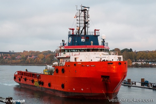
 ERRIE
ERRIE
Current Status
Where is the vessel?
ERRIE is currently in Near Luanda, based on AIS data received about 15h ago.
Latest AIS update:
Current position: 8.74069° S, 13.29913° E (Near Luanda)
Average speed (last 7 days): Loading…
Average speed (last 30 days): Loading…
Vessel profile: ERRIE is a Offshore Tug/Supply Ship with dimensions 67m x 16m.
This page combines live AIS, route history, probable destination signals, nearby traffic, and port activity for practical vessel monitoring.
The current position of vessel ERRIE is -8.74069 lat / 13.29913 lng. Updated: 2026-05-20 11:47:09 UTCNearest reference points:
- Near Luanda
- Near Greater Plutonio
Currently sailing under the flag of Liberia ![]()
ERRIE built in 2010 year
Deadweight:
2503 tDetails:
Live Vessel ERRIE Analytics (details, animations, etc.)
Recent AIS points (UTC):
2026-05-20 08:01:02 UTC · -8.74167, 13.29500 · SOG 0 kn · COG -1°2026-05-20 09:39:08 UTC · -8.74034, 13.29904 · SOG 0.1 kn · COG 78°
2026-05-20 10:26:08 UTC · -8.74056, 13.29894 · SOG 0.1 kn · COG 27°
2026-05-20 11:47:09 UTC · -8.74069, 13.29913 · SOG 0 kn · COG 344°