 Marianne
Current Status
Where is the vessel?
Marianne is currently in Near Hunsdon, based on AIS data received about 14h ago.
Latest AIS update:
Current position: 51.80519° N, 3.32679° E (Near Hunsdon)
Average speed (last 7 days): Loading…
Average speed (last 30 days): Loading…
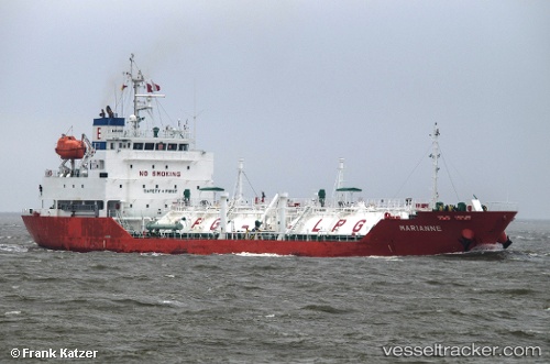
Vessel profile: Marianne is a Lpg Tanker with dimensions 98m x 97m.
This page combines live AIS, route history, probable destination signals, nearby traffic, and port activity for practical vessel monitoring.
The current position of vessel Marianne is 51.80519 lat / 3.32679 lng. Updated: 2026-05-21 01:45:25 UTCNearest reference points:
- Near Hunsdon
- 12 nm NE of Hunsdon
- Near OOSTWATERING
Currently sailing under the flag of Belgium ![]()
Marianne built in 2009 year
Deadweight:
4001 tDetails:
Live Vessel Marianne Analytics (details, animations, etc.)
Recent AIS points (UTC):
2026-05-20 23:06:25 UTC · 51.80537, 3.32470 · SOG 0.1 kn · COG 10°2026-05-20 23:24:25 UTC · 51.80535, 3.32472 · SOG 0.1 kn · COG 7°
2026-05-21 01:24:25 UTC · 51.80489, 3.32565 · SOG 0.1 kn · COG 337°
2026-05-21 01:45:25 UTC · 51.80519, 3.32679 · SOG 0.2 kn · COG 289°