 NEPTUNE MARINE
Current Status
Where is the vessel?
NEPTUNE MARINE is currently in 24 nm N of Port Said, based on AIS data received about 14h ago.
Latest AIS update:
Current position: 31.67041° N, 32.26943° E (24 nm N of Port Said)
Average speed (last 7 days): Loading…
Average speed (last 30 days): Loading…
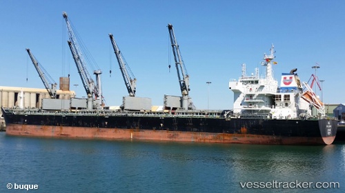
Vessel profile: NEPTUNE MARINE is a Bulk Carrier with dimensions m x m.
This page combines live AIS, route history, probable destination signals, nearby traffic, and port activity for practical vessel monitoring.
The current position of vessel NEPTUNE MARINE is 31.67041 lat / 32.26943 lng. Updated: 2026-07-05 04:29:38 UTCNearest reference points:
- 21 nm N of Port Said
- 16 nm N of Port Said
- 15 nm N of Port Said
Currently sailing under the flag of San Marino ![]()
Details:
Live Vessel NEPTUNE MARINE Analytics (details, animations, etc.)
Recent AIS points (UTC):
2026-07-05 02:11:38 UTC · 31.67019, 32.26928 · SOG 0.1 kn · COG 302°2026-07-05 02:29:38 UTC · 31.67025, 32.26929 · SOG 0 kn · COG 300°
2026-07-05 03:23:38 UTC · 31.67027, 32.26931 · SOG 0.1 kn · COG 299°
2026-07-05 04:29:38 UTC · 31.67041, 32.26943 · SOG 0.1 kn · COG 292°