 AFRICA HOPE
Current Status
Where is the vessel?
AFRICA HOPE is currently in 216 nm N of Port Mathurin, based on AIS data received about 15h ago.
Latest AIS update:
Current position: 16.08597° S, 63.31086° E (216 nm N of Port Mathurin)
Average speed (last 7 days): Loading…
Average speed (last 30 days): Loading…
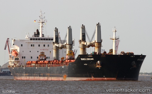
Vessel profile: AFRICA HOPE is a Bulk Carrier with dimensions 189m x 32m.
This page combines live AIS, route history, probable destination signals, nearby traffic, and port activity for practical vessel monitoring.
The current position of vessel AFRICA HOPE is -16.08597 lat / 63.31086 lng. Updated: 2026-05-25 19:29:59 UTCNearest reference points:
- 241 nm N of Port Mathurin
- 219 nm NW of Port Mathurin
- 154 nm NE of Port Mathurin
Currently sailing under the flag of Panama ![]()
AFRICA HOPE built in 2009 year
Deadweight:
53416 tDetails:
Live Vessel AFRICA HOPE Analytics (details, animations, etc.)
Recent AIS points (UTC):
2026-05-25 17:10:02 UTC · -16.29635, 62.98787 · SOG 9.6 kn · COG 58°2026-05-25 17:52:18 UTC · -16.23503, 63.08515 · SOG 9.6 kn · COG 59°
2026-05-25 19:24:27 UTC · -16.09333, 63.29667 · SOG 9 kn · COG -1°
2026-05-25 19:29:59 UTC · -16.08597, 63.31086 · SOG 9.7 kn · COG 59°