 CHATHAM ISLAND
Current Status
Where is the vessel?
CHATHAM ISLAND is currently in 88 nm NW of Sidi Ifni, based on AIS data received about 15h ago.
Latest AIS update:
Current position: 30.27458° N, 11.54415° W (88 nm NW of Sidi Ifni)
Average speed (last 7 days): Loading…
Average speed (last 30 days): Loading…
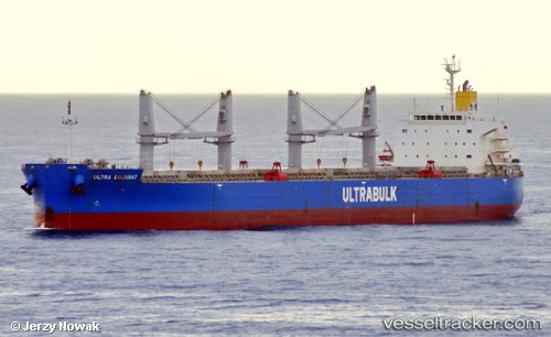
Vessel profile: CHATHAM ISLAND is a Bulk Carrier with dimensions m x m.
This page combines live AIS, route history, probable destination signals, nearby traffic, and port activity for practical vessel monitoring.
The current position of vessel CHATHAM ISLAND is 30.27458 lat / -11.54415 lng. Updated: 2026-05-20 01:54:35 UTCNearest reference points:
- 120 nm W of Anza
- 84 nm NE of ORZOLA
- 125 nm W of Essaouira
Currently sailing under the flag of Singapore ![]()
Details:
Live Vessel CHATHAM ISLAND Analytics (details, animations, etc.)
Recent AIS points (UTC):
2026-05-19 23:06:23 UTC · 30.73514, -11.13870 · SOG 12.5 kn · COG 217°2026-05-20 00:13:15 UTC · 30.55028, -11.29952 · SOG 12.6 kn · COG 215°
2026-05-20 01:16:15 UTC · 30.37636, -11.45236 · SOG 12.3 kn · COG 216°
2026-05-20 01:54:35 UTC · 30.27458, -11.54415 · SOG 12.2 kn · COG 217°