 vesseltracker.com
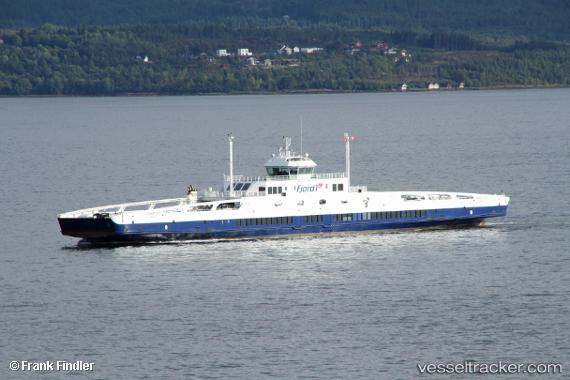
 Fannefjord
Current Status
Where is the vessel?
Fannefjord is currently in Near Kjøpsvik, based on AIS data received about 1h ago.
Latest AIS update:
Current position: 68.09527° N, 16.29498° E (Near Kjøpsvik)
Average speed (last 7 days): Loading…
Average speed (last 30 days): Loading…
Vessel profile: Fannefjord is a Passenger Ro Ro Cargo Ship with dimensions 123m x 122m.
This page combines live AIS, route history, probable destination signals, nearby traffic, and port activity for practical vessel monitoring.
The current position of vessel Fannefjord is 68.09527 lat / 16.29498 lng. Updated: 2026-04-05 12:09:33 UTCNearest reference points:
- Near Harstad
- Near Sigerfjord
- Near Hammerfall
Currently sailing under the flag of Norway ![]()
Fannefjord built in 2010 year
Deadweight:
857 tDetails:
Live Vessel Fannefjord Analytics (details, animations, etc.)
Recent AIS points (UTC):
2026-04-05 06:26:33 UTC · 68.08098, 16.18171 · SOG 10.4 kn · COG 232°2026-04-05 08:08:22 UTC · 68.09434, 16.31134 · SOG 10.6 kn · COG 283°
2026-04-05 09:43:06 UTC · 68.09064, 16.34778 · SOG 9.4 kn · COG 92°
2026-04-05 12:09:33 UTC · 68.09527, 16.29498 · SOG 11.5 kn · COG 285°