 MTM SINGAPORE
Current Status
Where is the vessel?
MTM SINGAPORE is currently in 96 nm N of Munshiganj, based on AIS data received about 17h ago.
Latest AIS update:
Current position: 25.03292° N, 91.16773° W (96 nm N of Munshiganj)
Average speed (last 7 days): Loading…
Average speed (last 30 days): Loading…
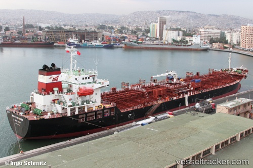
Vessel profile: MTM SINGAPORE is a Chemical Tanker with dimensions 24m x 145m.
This page combines live AIS, route history, probable destination signals, nearby traffic, and port activity for practical vessel monitoring.
The current position of vessel MTM SINGAPORE is 25.03292 lat / -91.16773 lng. Updated: 2026-05-23 09:55:01 UTCNearest reference points:
- 124 nm SW of Gulfmex Lightering Area
- 94 nm S of Gulfmex Lightering Area
Currently sailing under the flag of Singapore ![]()
MTM SINGAPORE built in 2011 year
Deadweight:
19996 tDetails:
Live Vessel MTM SINGAPORE Analytics (details, animations, etc.)
Recent AIS points (UTC):
2026-05-23 07:50:49 UTC · 25.03250, -91.12521 · SOG 1.1 kn · COG -1°2026-05-23 09:09:57 UTC · 25.03305, -91.15236 · SOG 1.1 kn · COG -1°
2026-05-23 09:55:01 UTC · 25.03292, -91.16773 · SOG 0.8 kn · COG -1°
2026-05-23 09:55:01 UTC · 25.03292, -91.16773 · SOG 0.8 kn · COG -1°