 Maria g
Current Status
Where is the vessel?
Maria g is currently in Near Gamcheon/Busan, based on AIS data received about 14h ago.
Latest AIS update:
Current position: 35.08288° N, 128.99742° E (Near Gamcheon/Busan)
Average speed (last 7 days): Loading…
Average speed (last 30 days): Loading…
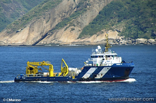
Vessel profile: Maria g is a Offshore Tug Supply Ship with dimensions 53m x 13m.
This page combines live AIS, route history, probable destination signals, nearby traffic, and port activity for practical vessel monitoring.
The current position of vessel Maria g is 35.08288 lat / 128.99742 lng. Updated: 2026-06-12 03:40:54 UTCNearest reference points:
- Near Gamcheon/Busan
- Near Busan
- Near BUSAN NEW PORT
Currently sailing under the flag of Panama ![]()
Maria g built in 2009 year
Deadweight:
1126 tDetails:
Live Vessel Maria g Analytics (details, animations, etc.)
Recent AIS points (UTC):
2026-06-12 00:28:19 UTC · 35.08288, 128.99736 · SOG 0 kn · COG 338°2026-06-12 01:42:59 UTC · 35.08285, 128.99741 · SOG 0 kn · COG 343°
2026-06-12 02:34:53 UTC · 35.08291, 128.99742 · SOG 0 kn · COG 343°
2026-06-12 03:40:54 UTC · 35.08288, 128.99742 · SOG 0 kn · COG 343°