 CAPE KOURION
Current Status
Where is the vessel?
CAPE KOURION is currently in 121 nm E of ONAGAWA, based on AIS data received about 16h ago.
Latest AIS update:
Current position: 37.99468° N, 143.95200° E (121 nm E of ONAGAWA)
Average speed (last 7 days): Loading…
Average speed (last 30 days): Loading…
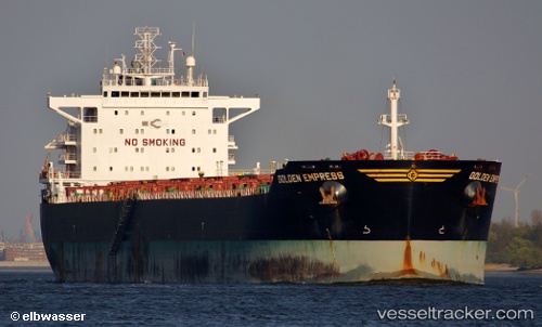
Vessel profile: CAPE KOURION is a Bulk Carrier with dimensions 229m x 32m.
This page combines live AIS, route history, probable destination signals, nearby traffic, and port activity for practical vessel monitoring.
The current position of vessel CAPE KOURION is 37.99468 lat / 143.95200 lng. Updated: 2026-06-23 06:35:14 UTCNearest reference points:
- 89 nm E of Kamaishi
- Near ONAGAWA
- Near OFUNATO
Currently sailing under the flag of Liberia ![]()
CAPE KOURION built in 2010 year
Deadweight:
79471 tDetails:
Live Vessel CAPE KOURION Analytics (details, animations, etc.)
Recent AIS points (UTC):
2026-06-23 03:54:21 UTC · 37.68552, 143.40826 · SOG 10.5 kn · COG 61°2026-06-23 05:36:42 UTC · 37.87860, 143.74918 · SOG 12.2 kn · COG 59°
2026-06-23 06:35:14 UTC · 37.99468, 143.95200 · SOG 12.6 kn · COG 73°
2026-06-23 06:35:14 UTC · 37.99468, 143.95200 · SOG 12.6 kn · COG 73°