 Ommax
Ommax
Current Status
Where is the vessel?
Ommax is currently in 22 nm W of Kastellorizou (ex Megísti), based on AIS data received about 14h ago.
Latest AIS update:
Current position: 36.19412° N, 29.15785° E (22 nm W of Kastellorizou (ex Megísti))
Average speed (last 7 days): Loading…
Average speed (last 30 days): Loading…
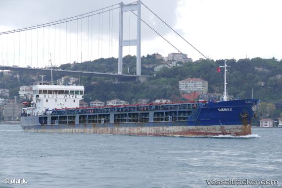
Vessel profile: Ommax is a General Cargo Ship with dimensions 108m x 15m.
This page combines live AIS, route history, probable destination signals, nearby traffic, and port activity for practical vessel monitoring.
The current position of vessel Ommax is 36.19412 lat / 29.15785 lng. Updated: 2026-05-21 02:03:40 UTCNearest reference points:
- Near Fethiye
- Near KAS
- Near GOCEK
Currently sailing under the flag of Comoros ![]()
Ommax built in 2010 year
Deadweight:
3662 tDetails:
Live Vessel Ommax Analytics (details, animations, etc.)
Recent AIS points (UTC):
2026-05-20 22:15:47 UTC · 36.09143, 29.66715 · SOG 7.2 kn · COG 266°2026-05-21 00:19:22 UTC · 36.11549, 29.38716 · SOG 6.6 kn · COG 287°
2026-05-21 01:01:02 UTC · 36.14474, 29.29628 · SOG 6.4 kn · COG 255°
2026-05-21 02:03:40 UTC · 36.19412, 29.15785 · SOG 7.2 kn · COG 286°