 MIKE BAY
Current Status
Where is the vessel?
MIKE BAY is currently in Near São Luís, based on AIS data received about 15h ago.
Latest AIS update:
Current position: 2.36980° S, 44.26932° W (Near São Luís)
Average speed (last 7 days): Loading…
Average speed (last 30 days): Loading…
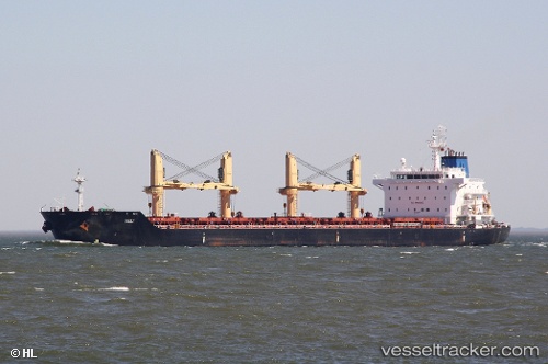
Vessel profile: MIKE BAY is a Bulk Carrier with dimensions 30m x 180m.
This page combines live AIS, route history, probable destination signals, nearby traffic, and port activity for practical vessel monitoring.
The current position of vessel MIKE BAY is -2.36980 lat / -44.26932 lng. Updated: 2026-07-12 01:57:25 UTCNearest reference points:
- 53 nm N of Beija-Flor
Currently sailing under the flag of Marshall Islands ![]()
MIKE BAY built in 2010 year
Deadweight:
34529 tDetails:
Live Vessel MIKE BAY Analytics (details, animations, etc.)
Recent AIS points (UTC):
2026-07-11 23:00:23 UTC · -2.36891, -44.26933 · SOG 0 kn · COG 177°2026-07-12 00:24:23 UTC · -2.36903, -44.26897 · SOG 0 kn · COG 187°
2026-07-12 01:48:26 UTC · -2.36937, -44.26907 · SOG 0.1 kn · COG 180°
2026-07-12 01:57:25 UTC · -2.36980, -44.26932 · SOG 0.2 kn · COG 177°