 Conmarynue
Current Status
Where is the vessel?
Conmarynue is currently in Near Lisboa-EXPO, based on AIS data received about 14h ago.
Latest AIS update:
Current position: 38.72106° N, 9.11316° W (Near Lisboa-EXPO)
Average speed (last 7 days): Loading…
Average speed (last 30 days): Loading…
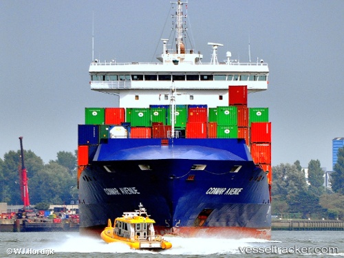
Vessel profile: Conmarynue is a Container Ship with dimensions 151m x 24m.
This page combines live AIS, route history, probable destination signals, nearby traffic, and port activity for practical vessel monitoring.
The current position of vessel Conmarynue is 38.72106 lat / -9.11316 lng. Updated: 2026-05-21 16:23:36 UTCNearest reference points:
- Near Lisboa
- Near COVA DA PIEDADE
- Near Memória
Currently sailing under the flag of Antigua Barbuda ![]()
Conmarynue built in 2012 year
Deadweight:
13000 tDetails:
Live Vessel Conmarynue Analytics (details, animations, etc.)
Recent AIS points (UTC):
2026-05-21 12:26:35 UTC · 38.72105, -9.11314 · SOG 0 kn · COG 41°2026-05-21 13:11:37 UTC · 38.72105, -9.11314 · SOG 0 kn · COG 42°
2026-05-21 13:35:37 UTC · 38.72106, -9.11314 · SOG 0 kn · COG 42°
2026-05-21 16:23:36 UTC · 38.72106, -9.11316 · SOG 0 kn · COG 42°