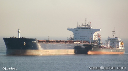
W ace
Current StatusWhere is the vessel?
W ace is currently in 18 nm NE of Conflict Group, based on AIS data received about 14h ago.
Latest AIS update:
Current position: 10.56667° S, 152.01334° E (18 nm NE of Conflict Group)
Average speed (last 7 days): Loading…
Average speed (last 30 days): Loading…
Vessel profile: W ace is a Bulk Carrier with dimensions 38m x 229m.
This page combines live AIS, route history, probable destination signals, nearby traffic, and port activity for practical vessel monitoring.
The current position of vessel W ace is -10.56667 lat / 152.01334 lng. Updated: 2026-06-13 06:11:59 UTCDetails:
Live Vessel W ace Analytics (details, animations, etc.)
Recent AIS points (UTC):
2026-06-13 02:37:39 UTC · -10.06937, 151.70348 · SOG 9.2 kn · COG 155°2026-06-13 03:25:11 UTC · -10.18732, 151.74687 · SOG 9.5 kn · COG 162°
2026-06-13 04:18:01 UTC · -10.32667, 151.79167 · SOG 10 kn · COG -1°
2026-06-13 06:11:59 UTC · -10.56667, 152.01334 · SOG 10 kn · COG -1°