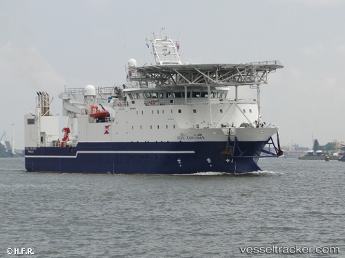
 Stril Explorer
Current Status
Where is the vessel?
Stril Explorer is currently in Near Cidade de Angra dos Reis FPSO, based on AIS data received about 15h ago.
Latest AIS update:
Current position: 25.39563° S, 42.75837° W (Near Cidade de Angra dos Reis FPSO)
Average speed (last 7 days): Loading…
Average speed (last 30 days): Loading…
Vessel profile: Stril Explorer is a Offshore Support Vessel with dimensions 76m x 16m.
This page combines live AIS, route history, probable destination signals, nearby traffic, and port activity for practical vessel monitoring.
The current position of vessel Stril Explorer is -25.39563 lat / -42.75837 lng. Updated: 2026-06-13 09:31:51 UTCNearest reference points:
- 34 nm S of Cidade de Angra dos Reis FPSO
- 69 nm NE of Cidade de Angra dos Reis FPSO
- 49 nm S of SEPETIBA
Currently sailing under the flag of Norway ![]()
Stril Explorer built in 2010 year
Deadweight:
1400 tDetails:
Live Vessel Stril Explorer Analytics (details, animations, etc.)
Recent AIS points (UTC):
2026-06-13 05:22:30 UTC · -25.39333, -42.75333 · SOG 0 kn · COG -1°2026-06-13 07:52:28 UTC · -25.39667, -42.75667 · SOG 0 kn · COG -1°
2026-06-13 08:04:28 UTC · -25.39667, -42.75667 · SOG 0 kn · COG -1°
2026-06-13 09:31:51 UTC · -25.39563, -42.75837 · SOG 0 kn · COG 354°