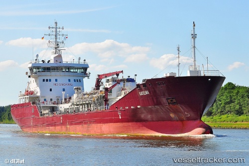
 KATELINA
Current Status
Where is the vessel?
KATELINA is currently in Near Porthgwarra, based on AIS data received about 14h ago.
Latest AIS update:
Current position: 49.91439° N, 5.70534° W (Near Porthgwarra)
Average speed (last 7 days): Loading…
Average speed (last 30 days): Loading…
Vessel profile: KATELINA is a Tanker with dimensions m x m.
This page combines live AIS, route history, probable destination signals, nearby traffic, and port activity for practical vessel monitoring.
The current position of vessel KATELINA is 49.91439 lat / -5.70534 lng. Updated: 2026-05-20 01:56:01 UTCNearest reference points:
- 28 nm S of Porthgwarra
- Near Cadgwith
- Near Isles of Scilly
Currently sailing under the flag of Portugal ![]()
Details:
Live Vessel KATELINA Analytics (details, animations, etc.)
Recent AIS points (UTC):
2026-05-19 23:07:21 UTC · 50.27426, -6.00960 · SOG 9.9 kn · COG 184°2026-05-20 00:10:01 UTC · 50.09076, -6.01107 · SOG 10.1 kn · COG 179°
2026-05-20 01:14:31 UTC · 49.92572, -5.90576 · SOG 11.2 kn · COG 100°
2026-05-20 01:56:01 UTC · 49.91439, -5.70534 · SOG 11 kn · COG 93°