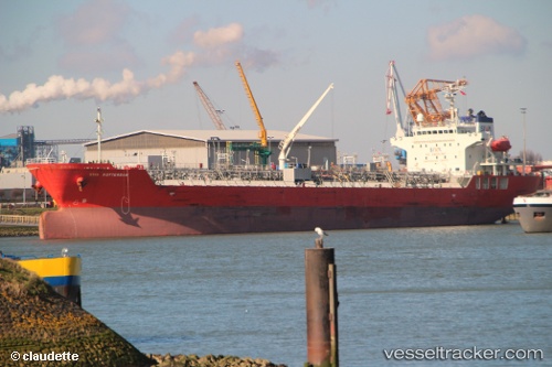
Fg Rotterdam
Current StatusWhere is the vessel?
Fg Rotterdam is currently in 24 nm W of Cape Of Good Hope, based on AIS data received about 14h ago.
Latest AIS update:
Current position: 34.41771° S, 17.90479° E (24 nm W of Cape Of Good Hope)
Average speed (last 7 days): Loading…
Average speed (last 30 days): Loading…
Vessel profile: Fg Rotterdam is a Chemical Oil Products Tanker with dimensions 24m x 144m.
This page combines live AIS, route history, probable destination signals, nearby traffic, and port activity for practical vessel monitoring.
The current position of vessel Fg Rotterdam is -34.41771 lat / 17.90479 lng. Updated: 2026-05-20 23:25:58 UTCNearest reference points:
- 18 nm SW of Cape Of Good Hope
- Near HOUT BAY
- 12 nm W of ROBBEN ISLAND
Details:
Live Vessel Fg Rotterdam Analytics (details, animations, etc.)
Recent AIS points (UTC):
2026-05-20 19:01:37 UTC · -34.86568, 18.81686 · SOG 11.7 kn · COG 290°2026-05-20 22:02:18 UTC · -34.63216, 18.16050 · SOG 12.6 kn · COG 320°
2026-05-20 23:04:30 UTC · -34.47386, 17.96594 · SOG 12.7 kn · COG 318°
2026-05-20 23:25:58 UTC · -34.41771, 17.90479 · SOG 12.2 kn · COG 318°