 vesseltracker.com
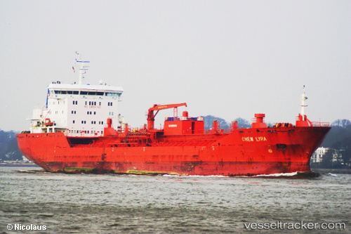
 Chem Lyra
Current Status
Where is the vessel?
Chem Lyra is currently in 64 nm E of Langsa Venture FPSO, based on AIS data received less than 1h ago.
Latest AIS update:
Current position: 5.06833° N, 99.08500° E (64 nm E of Langsa Venture FPSO)
Average speed (last 7 days): Loading…
Average speed (last 30 days): Loading…
Vessel profile: Chem Lyra is a Chemical Oil Products Tanker with dimensions 144m x 144m.
This page combines live AIS, route history, probable destination signals, nearby traffic, and port activity for practical vessel monitoring.
The current position of vessel Chem Lyra is 5.06833 lat / 99.08500 lng. Updated: 2026-04-29 21:26:56 UTCNearest reference points:
- 43 nm NE of PANGKALAN SUSU
- 18 nm E of Langsa Venture FPSO
- 43 nm NE of Perbaungan
Currently sailing under the flag of Liberia ![]()
Chem Lyra built in 2009 year
Deadweight:
17055 tDetails:
Live Vessel Chem Lyra Analytics (details, animations, etc.)
Recent AIS points (UTC):
2026-04-29 17:38:53 UTC · 4.55500, 99.46667 · SOG 9 kn · COG -1°2026-04-29 19:29:55 UTC · 4.79167, 99.28500 · SOG 9 kn · COG -1°
2026-04-29 19:53:55 UTC · 4.84667, 99.24333 · SOG 10 kn · COG -1°
2026-04-29 21:26:56 UTC · 5.06833, 99.08500 · SOG 10 kn · COG -1°